


")


 on Hardback by J.R.R. Tolkien")


")


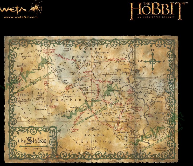
From Michel Delving in the West to Bucklebury in the East, from Greenfields in the North to Sackville in the South, Daniel Reeve's map plots all the familiar places in the four farthings of the Shire. It shows the way to places like Tuckborough, Frogmorton, Brockenboring and Tooksbank. It helps you choose whether to cross the Brandywine on the bridge or by the Bucklebury Ferry. All annotated in helpful fashion by one Bilbo Baggins of Hobbiton in the West Farthing.
The original prop for The Hobbit: An Unexpected Journey was designed and drawn by Daniel Reeve of the 3 Foot 7 art department. Weta's map of the Shire has been made from a scan of the original map and printed in Middle-earth (New Zealand) on finest Italian Marina Conchiglia parchment paper.
Map of the Shire – Parchment Art Print is a gorgeous print with die-cut edges to add to the authenticity. The Map of the Shire is part of a range of Middle-earth maps from Weta.
Dimensions: 21.3" x 29.1" (H x W x D), 54 cm x 74 cm
The main image shown is of a digital file and the image with the poster tube is of a production print. Note: The images are watermarked Weta NZ (this is not on actual print).